


서울·수도권 이외 지역에 오후부터 '비'
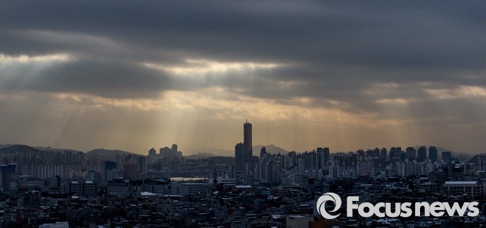 |
| △ 구름 사이로 내리는 태양빛 |
(서울=포커스뉴스) 목요일인 17일은 일본 남쪽해상에 위치한 고기압의 가장자리에 들다가 점차 서쪽에서 다가오는 기압골의 영향을 받겠다.
이에 따라 전국은 대체로 맑다가 낮부터 차차 흐려질 전망이다.
늦은 오후에는 제주도를 시작으로 남부지방과 충청남부에 비(강수확률 60~80%)가 내리겠다.
예상되는 강수량은 18일 밤까지 전라남도·경상남도·제주도 20~60㎜, 전라북도·경상북도 10~40㎜이다.
18일부터는 충청남도·충청북도·울릉도·독도(5~20㎜)와 경기남부·강원남부(5㎜미만)에도 비가 내리겠다.
아침 최저기온은 영하 3도에서 영상 8도, 낮 최고기온은 13도에서 20도로 예상돼 평년보다 높은 기온 분포가 예상된다.
서울·수도권의 아침 최저기온은 영하 2도에서 영상 3도, 낮 최고기온은 13도에서 17도가 되겠다.
서해상에는 안개가 끼는 곳이 있겠으며, 바다의 물결은 전해상에서 0.5~2.0m로 일겠다.
기상청은 "낮과 밤의 기온차가 10도 내외로 크기 때문에 건강관리에 유의해야 한다"고 당부했다.
지역별 날씨
3월 17일(목요일)서울점차 흐림3~15℃강수 확률 10~30%춘천점차 흐림-1~16℃10~30%강릉점차 흐림6~18℃0~20%대전흐리다 비2~18℃10~60%청주점차 흐림3~18℃10~30%대구점차 흐림4~19℃0~30%전주흐리다 비3~19℃10~60%광주흐리다 비5~19℃10~60%부산점차 흐림8~17℃10~30%제주흐리다 비12~22℃20~70%울릉·독도점차 흐림4~19℃0~20%자료: 기상청.focus_w_t_box:after, .focus_w_t_wrapper:after{clear:both;display:block;content:"";}.focus_w_t_wrapper {list-style:none;max-width:700px; padding:0px;margin:0px;margin:auto;position:relative; position: relative !important;top: 0px !important;left: 0px !important;height:auto !important;}.focus_w_t_wrapper li{width:49%;max-width:174px;float:left;border:1px solid RGB(199, 199, 199);margin-left:-1px;margin-top:-1px;position: relative;height:132px !important;vertical-align: top;cursor: pointer; }.focus_w_t_m, .focus_w_t_m_1, .focus_w_t_m_2{ table-layout: fixed;width:100%;height:132px;border-collapse: collapse; font-family: 나눔고딕, NanumGothic, sans-serif; background-color:white;}.focus_w_t_m_1 td, .focus_w_t_m_2 td{ text-align:center; }.focus_w_t_m td{text-align:center;}.focus_w_t_m_1 .focus_tit, .focus_w_t_m_2 .focus_tit{background-color:rgb(81, 143, 187); color:white;font-weight:bold;height:29px;}.focus_w_t_m {background-color:rgb(225, 225, 225);}.focus_w_t_m_2{background-color:rgb(235, 235, 235);}.focus_p{background-color:rgb(235, 235, 235);color:rgb(102, 102, 102);font-weight:bold;border-top:1px solid RGB(199, 199, 199);}.focus_temp{font-weight:bold;}강진형 기자
[저작권자ⓒ 부자동네타임즈. 무단전재-재배포 금지]